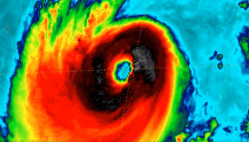
L'actualité cyclonique mondiale est actuellement marquée par l'ouragan BUD qui évolue dans le nord-est du pacifique. Le CIMSS (Cooperative Institute for Meteorological Satellite Studies) a publié sur son blog une magnifique animation satellite du cyclone au moment ou celui était à son pic d'intensité.
Déjà le deuxième ouragan majeur de la saison
L'oeil un indice sur l'état de forme d'un cyclone
Commentaires
-
 Hurricane Bud was assigned Category Two and brought powerful rains to the Mexican city of Guadalajara. There is a video where one can see how, within a few hours, flooding began, the water level rose to 4 meters, and many streets of Guadalajara turned into rivers while cars were drowning. This was already a second hurricane of that season. You know, at such times, you understand that when disasters happen, that only by uniting can we overcome and get through any trials and hard times. That is why I am writing here to recommend that everyone take a look at a wonderful international project - The Climate Control Global Project. This association unites people from different countries and of different nationalities in order to help each other and look for a way out of the current climatic situation.
 -
 Sorry english, but i have the video from fantala, amazing to see cyclones like this.
Ajouter un commentaire
